Sea Floor Plate Boundaries
Plate boundaries are found at the edge of the lithospheric plates and are of three types, convergent, divergent and conservative. Wide zones of deformation are usually characteristic of plate boundaries because of the interaction between two plates. The three boundaries are characterized by their distinct motions.
The first sort of plate boundary is called a divergent boundary, or spreading center. At these boundaries, two plates move away from one another. As the two move apart, mid-ocean ridges are created as magma from the mantle upwells through a crack in the oceanic crust and cools. This, in turn, causes the growth of oceanic crust on either side of the vents. As the plates continue to move, and more crust is formed, the ocean basin expands and a ridge system is created. Divergent boundaries are responsible in part for driving the motion of the plates.
As you can imagine, the formation of the new crust on either side of the vents would act to push plates apart, as we see at the Mid-Atlantic Ridge, which helps to move North America and Europe further and further apart. Mid-ocean ridges are vast mountain chains in the ocean and are as tall if not taller than mountain chains on land. The process which actually drives the motion at these ridges is known as convection. Magma is pushed upwards through the ridge cracks by convection currents. As some magma erupts out through the crust, the magma which does not erupt continues to move under the crust with the current away from the ridge crest. These continual convection currents, called convection cells, help to move the plates away from each other to allow more crust to be created and the sea floor to grow. This phenomenon is known as sea-floor spreading.
The mid-ocean ridges also play a very crucial role in the development of plate tectonic theory, because of the unique quality that minerals within the basalt possess. Basalt contains a fair amount of magnetic minerals, which align to the Earth's magnetic field upon crystallization. In the past, Earth's magnetic field has been known to change polarity, causing a reversal in the magnetic field, which is preserved when the crystals form. The alignment of these magnetic minerals can be used to date the crust, since they can be correlated with ages of known magnetic reversals in Earth's history. This plays a key role in the development of plate tectonic theory because it was the first positive proof that the plates were indeed moving and had been for most of geologic time. By using the magnetic reversal information preserved in the minerals of the mid-ocean ridge basalts, scientists were able to prove that the plates were moving, and that new crust was being formed and old crust was being destroyed in a continuous process that had been going on for most of Earth's history. The oldest crust in the ocean dates back to the early Cretaceous, 100-65 million years ago, which is relatively recent in geologic time.
If this is the case, where did all the rest of the crust go?
This leads us to the second type of plate boundary, which is called a convergent boundary or subduction zone. These are plate margins where one plate is overriding another, thereby forcing the other into the mantle beneath it. These boundaries are in the form of trench and island arc systems. All the old oceanic crust is going into these systems as new crust is formed at the spreading centers. Convergent boundaries also explain why crust older than the Cretaceous cannot be found in any ocean basin-- it has already been destroyed by the process of subduction.

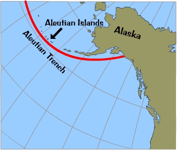
Subduction zones are the location of very strong earthquakes, which occur because the action of the down going slab interacts with the overriding slab. The "Ring of Fire" around the margins of the Pacific Ocean is due precisely to the subduction zones found around the edges of the Pacific plate. Subduction also is the cause of the volcanic activity in places like Japan: as the downgoing slab goes deeper beneath the overriding plate, it becomes hotter and hotter because of its proximity to the mantle. This causes the slab to melt and form magma, which moves upward through the crust and eventually forms volcanoes (island arcs) in oceanic crust or huge intrusive masses (plutons and batholiths) in continental crust. The Aleutian Islands are another example of a surface expression of subduction.

The third type of plate boundary is called a conservative or transform boundary. It is called conservative because plate material is neither created nor destroyed at these boundaries, but rather plates slide past each other. The classic example of a transform plate boundary is the San Andreas fault in California. The North American and Pacific Plates are moving past each other at this boundary, which is the location of many earthquakes. These earthquakes are caused by the accumulation and release of strain as the two plates slide past each other. Another example of a transform boundary is seen at the mid-ocean ridges, where the spreading centers are offset by transform faults anywhere from a few meters to several kilometers in length.
 Deep Sea Crabs