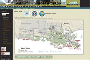
Updated Gulf of Mexico Marine Debris Mapping Web Site Now Available As Surveying Efforts Continue in Louisiana - August 7, 2008

In a continuing effort to improve maritime safety and commerce in the northern Gulf of Mexico, NOAA has revised the Gulf of Mexico Marine Debris Project Web site, an outlet for hydrographic survey data identifying risks posed by debris left in the wake of Hurricanes Katrina and Rita. Submerged marine debris is a threat to viable commercial fishing and shrimping activities in the northern Gulf of Mexico coastal zone.
The updated Web site provides information on both offshore and inshore debris surveys and removal efforts currently underway. For offshore areas, the Web site provides sonar survey information, including maps where the location of marine debris has been identified. For inshore areas, the Web site displays survey maps of waterways identified as having debris issues, along with photos of debris, sunken vessels, and the occasional alligator. Site content is provided jointly by NOAA and the Coast Guard.
"A user can click on a surveyed offshore area and download maps displaying sonar targets. Likewise, a user may click on the name of a Parish, then click on a specific waterway, and view maps and photos provided by the U.S. Coast Guard.," said Nir Barnea, project manager for the Gulf of Mexico Marine Debris Project.
"A local user can obtain information on specific waterways, view debris location and photos, and be informed of potential boating hazards. A casual, non-local user gains a snapshot of the environment in Louisiana, the work being conducted, and the impact that Hurricanes Katrina and Rita are still having on daily activities," says Barnea.
As a result of the 2005 hurricane season, the coastal zones of Louisiana, Mississippi, and Alabama were littered with debris presenting hazards to safe navigation, commercial fishing, recreational boating, and other normal coastal uses. The major sources of debris include materials that have washed from the impacted coastal areas as a result of storm surge and retreating flood-waters. Wrecked and lost recreational and commercial vessels have also contributed to the marine debris hazard. Some of the debris also originated from the numerous offshore oil and gas facilities that were destroyed or heavily damaged by the hurricane force winds and heavy storm surge.
NOAA has been surveying coastal Gulf waters from Alabama to Louisiana since fall 2006, and in April 2008 started operations in South Plaquemines, Louisiana. The revised Web site focuses on Louisiana, where the USCG is coordinating with the State of Louisiana to survey and remove marine debris from inshore waterways impacted by Hurricanes Katrina and Rita.
 Deep Sea Crabs